Blato
-
Potomje Dingač Borak
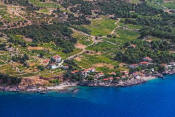
“Life between locations” might not sound like the life everyone would wish. But if those places are Potomje, an ancient settlement situated in the enchanting vale covered in vineyards, and Dingač, its wine country where one of the world’s best grape varieties is cultivated, things are definitely looking up. More than that, they are soaring.
Situated 320 m above the sea level, Potomje can give all the best life has to offer in the beautiful peninsula inland, while the aroma of the sunny Mediterranean lingers in Dingač. These two uniquely beautiful sides of Pelješac are connected via a 400 m long tunnel built by the local residents for easier access to their coastal vineyards. If you are yearning for true countryside nature, pay a visit to the land of dreams in the tranquillity of Potomje, and the next day head over to Dingač for a cup of morning coffee and a slice of Mediterranean fun. The sound of crickets chirping, the aroma of pine trees and crystal clear sea... Top that off with a glass of famous Dingač and life between locations has never sounded better.
Source: https://www.visitorebic-croatia.hr/
Korčula
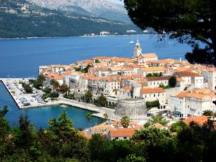
Korčula is an island in the Adriatic Sea, in the Dubrovnik-Neretva County of Croatia. The island has an area of 279 km2 (108 sq mi); 46.8 km (29.1 mi) long and on average 7.8 km (4.8 mi) wide — and lies just off the Dalmatian coast. Its 16,182 (2001) inhabitants make it the second most populous Adriatic island after Krk and the most populous Croatian island not connected to the mainland by a bridge. The population are mainly ethnic Croats (96.77%).
Korčula is a historic fortified town on the protected east coast of the island of Korčula
The old city is surrounded by walls, and the streets are arranged in a herringbone pattern allowing free circulation of air but protecting against strong winds. The town's historic sites include the central Gothic and Renaissance Cathedral of St Mark, the Town Hall and the massive city fortifications. The 15th-century Franciscan monastery with a beautiful cloister is situated on the islet of Badija, near Korčula Town.
Korčula is a historic fortified town on the protected east coast of the island of Korčula
http://www.visitkorcula.eu/places.html
Orebić
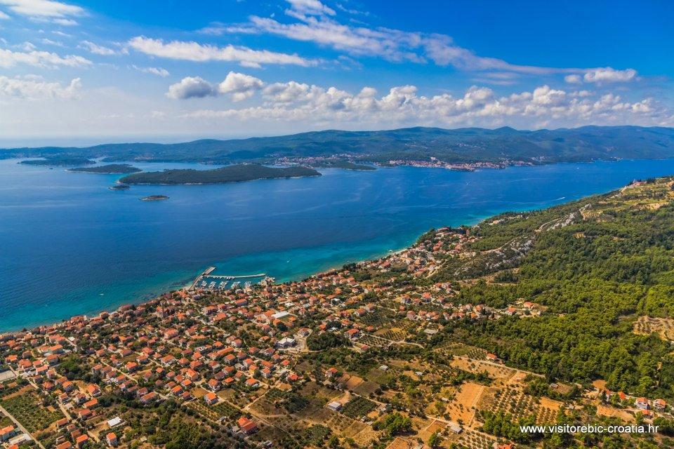
Mimbelli family mausoleum erected amid the serene walls of the Franciscan monastery and the Church of Our Lady of Angels, with one of the most gorgeous views over the Mediterranean, tells the story of the town of Orebić. It is a story about the sea, beauty and love. Mimbellis are among the greatest captain families in Orebić, the small town sometimes referred to as the “Birthplace of Captains”. When they weren’t sailing the seas, the captains built their faithful wives lavish gardens with the most beautiful flowers from their journeys as a sign of affection. Each year, the captains’ gardens spread the aroma of distant worlds, which excites the imagination of countless visitors as they enjoy sandy beaches and crystal clear waters in Orebić.
We can only guess how Baldo Mimbelli’s garden would look like, if he had built it for the person of his heart’s desire – his beautiful maid. But the family forbade their marriage and Baldo spent his life searching for beauty. If you also are searching for beauty, Orebić is the place for you. It is situated at the foot of Sv. Ilija, the highest peak on Pelješac, with a view over the entire Pelješac Canal and the island of Korčula, only a 15 minute boat ride away. Add in the beautiful beaches, crystal clear sea and best wines in the world, and you will surely be captivated. Whether you’d like to visit captains’ houses and museums in search of a romantic past or you prefer active vacation on picturesque beaches and wandering the pristine nature of its forests and mountains, you will fall in love with Orebić. Mimbelli family Mausoleum built by Baldo Mimbelli, the one guarding the town’s secret, is a monument to a great love. It is up to you to fall in love by dancing on its terraces and drinking the best wine, and to discover on your own the secret of Orebić, the secret of love...
Source: Orebic Tourist Board, https://www.visitorebic-croatia.hr/
Žrnovo
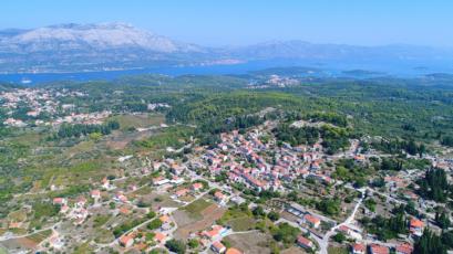
The village of Žrnovo is situated 4 km from the town of Korčula.
Nearby there are recently grown inhabited settlements located by the sea: Medvinjak, Žrnovska Banja, Vrbovica, Oskorušica and many bays, named «na defora» facing islands of Lastovo and Mljet.
Žrnovo is remarquably picturesque with its four hamlets Brdo, Prvo selo, Kampuš, Postrana.
Each of the settlements is crowned by fascinated fairy tales landscapes, rural architecture, vegetation, Kočje (protected area), a number of legends and oral traditions.
Žrnovo as a whole is very suitable for touring hikers making it an excellent base for developing the local gastronomy.
Patron saints: St. Antony, on June the 13th –Brdo, St. Rocco, on August the 16th –Postrana, Nativity of the Virgin Mary, on September the 8th–Prvo selo, St. Martin, on November the 11th–Kampuš.
Source:https://www.visitkorcula.eu/zrnovo-korcula.html
Prižba
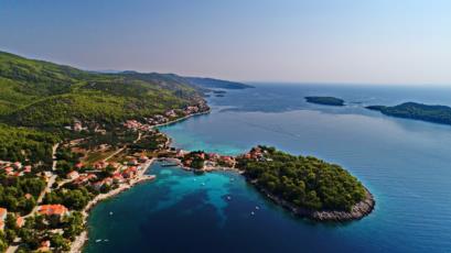
On the southern side of the island Blato’s coves start with Slatina on the west to Vinačac on the east. The southern shore is more indented, but partially very steep, too – at some places the cliffs are 30 m high. There are many anchorages and coves protected from the northern winds but open towards the southern ones: Prižba, Gršćica, Karbuni and Triporte.
Southern coast is followed by a string of smaller and larger islands that are particularly popular destination for kayak or motorboat trips. From the southern side of the island of Korčula you can see the island of Lastovo and the open sea, and sometimes, on the clear days, Italian mountains are visible.
In every cove there are vacation houses with apartments to rent, and larger coves are Prižba, Gršćica and Karbuni.
Prižba
Prižba is made of several smaller coves: Podjamje, Danca, Mala and Velika Prižba and two small peninsulas: Ratak and Prišćapac. Prišćapac is also a tourist resort with pebbles beach and all the tourist services.
From both sides of the peninsula of Ratak are pebbles beaches and close to those are a campsite, a café, a restaurant and a grocery store. On the peninsula of Ratak there is the small monastery of the Daughters of Mercy where the mass is held on summer Sundays.
In Prižba you can rent a motorboat and take it you to the nearby islands that are only around 800 m away from the coast. The islands are Vrhovnjak, Sritnjak, Crklica and Stupa, they are uninhabited, and have many spots suitable for sunbathing and swimming.
On the peninsula of Prišćapac there is the diving centre. The professional staff organises diving trips and diving instructions.
Lastovo Skrivena Luka
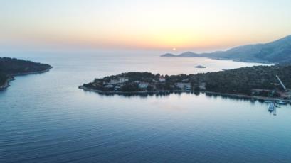
Situated on Lastovo’s southern coast is Skrivena Luka, one of the island’s largest and most beautiful bays.
Skrivena Luka, as it’s name reveals, is ‘a hidden bay’, exceptionally attractive for its private and somewhat secret location which cannot be directly seen from the open sea.
On entering the bay by sea, guests are welcomed by the Cape of Struga Lighthosue built in 1839 on its dramatic cliff-side pedestal 90 meters above sea level. The lighthouse is available exclusively for renting all year round with 4 apartments for 2 – 5 people in each.
Source : https://tz-lastovo.hr/en/vodic-po-lastovu/naselja/skrivena-luka-bay/
Račišće
-
Rogotin
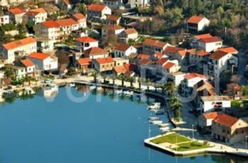
Rogotin is located halfway between Split and Dubrovnik, on an island surrounded by the Black River on the north side and its tributary on the southwest, which connects it with the Adriatic Sea with its western symbol, Lake Vlaška. According to tradition, Rogotin began to settle in 1716, when the Venetians left Citluk (Gabela) to the Turks, and the population withdrew after the army under Venetian rule. For a long time, Rogotin was an isolated settlement, which could be approached by waterways - the Black River and the Neretva. At first, the people of Rogotin were engaged in agriculture, and in addition to agriculture, the source of livelihood was fishing and fox hunting.
Once a small and isolated village, Rogotin is today fully open and integrated into modern life, which economically connects it mainly with nearby Ploče, and culturally with the whole of Dalmatia and Croatia, without losing any of its traditionalness that makes it one of the most characteristic and recognizable Neretva places.
Source: www.rogotin.hr
Mlini
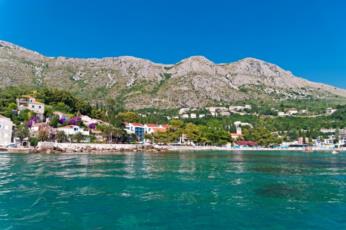
Mlini used to be the ancient historical settlement Molina. This was the centre of the milling trade, and a long time ago it was often mentioned because before the water system was built water was taken from here to Dubrovnik, especially in the summer months when there was a drought. In the 15th century, two boats regularly carried drinking water from Mlini to Dubrovnik. The village got its name thanks to the abundant springs on which the mills were built, and out of the former mills only one has been kept intact.
Boats came to Mlini in the 19th century, not only from the city, the whole of Župa, and neighbouring Konavle and Herzegovina, but also from the Ukraine and were carrying wheat that was milled here. And whilst the men worked in the mills, the woman sewed and washed the bags for flour.
After 1897, the mill grindstones used electric energy from their own central power Station in the mill “Marija”.
In a historical account of Dubrovnik Serafin Razzi writes about this region: “At the end of these valleys, which they call Župa, a Frenchman, whose name is not remembered, came to shore with his boat, and, noticed that not far from the coast, on the karst side and the side of the stone hill, an abundance of fresh water flowed. He soon decided to build a few large mills for milling corn. After than less than half a mile this spring water flows into the sea”.
The parish Church of St. Hilarion (sv. Ilar) “sancti Hylacrioni” is located in the oldest part of Mlini, whose name has its roots from the Greek word ilaros, as well as the Latin word hilaris which means happy, joyful, vivacious. It is mentioned in the Dubrovnik Statute in 1272. This old church with its graveyard “ which is remembered in memories is older than the documents about it. The old local chronicles mention it in 1164”. During the century, it was destroyed and constantly renovated. It was badly damaged, especially in the earthquake of 1667, and renovated in 1683 in a Baroque style. It was damaged again in the earthquakes of 1823 and 1824. According to ancient legend, St. Hilary, a hermit and saint of Palestinian origins, killed a dragon on the coast of Mlini and freed this area from paganism. This is why St. Hilarion (sv. Ilar) christened it Illyria in the 4th century. According to historical sources the people of Hilarion were shepherds and were scared of snakes. The church was built in honour of St. Hilarion (sv. Ilar), who became the patron saint of Mlini, and on the big bell that is dedicated to him it writes “I remind the people of St. Hilarion that you destroyed the dragon of paganism here. MCMXXV”.
Lumbarda
-
Mlini
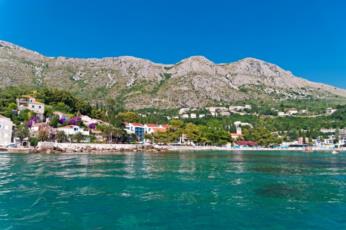
Mlini used to be the ancient historical settlement Molina. This was the centre of the milling trade, and a long time ago it was often mentioned because before the water system was built water was taken from here to Dubrovnik, especially in the summer months when there was a drought. In the 15th century, two boats regularly carried drinking water from Mlini to Dubrovnik. The village got its name thanks to the abundant springs on which the mills were built, and out of the former mills only one has been kept intact.
Boats came to Mlini in the 19th century, not only from the city, the whole of Župa, and neighbouring Konavle and Herzegovina, but also from the Ukraine and were carrying wheat that was milled here. And whilst the men worked in the mills, the woman sewed and washed the bags for flour.
After 1897, the mill grindstones used electric energy from their own central power Station in the mill “Marija”.
In a historical account of Dubrovnik Serafin Razzi writes about this region: “At the end of these valleys, which they call Župa, a Frenchman, whose name is not remembered, came to shore with his boat, and, noticed that not far from the coast, on the karst side and the side of the stone hill, an abundance of fresh water flowed. He soon decided to build a few large mills for milling corn. After than less than half a mile this spring water flows into the sea”.
The parish Church of St. Hilarion (sv. Ilar) “sancti Hylacrioni” is located in the oldest part of Mlini, whose name has its roots from the Greek word ilaros, as well as the Latin word hilaris which means happy, joyful, vivacious. It is mentioned in the Dubrovnik Statute in 1272. This old church with its graveyard “ which is remembered in memories is older than the documents about it. The old local chronicles mention it in 1164”. During the century, it was destroyed and constantly renovated. It was badly damaged, especially in the earthquake of 1667, and renovated in 1683 in a Baroque style. It was damaged again in the earthquakes of 1823 and 1824. According to ancient legend, St. Hilary, a hermit and saint of Palestinian origins, killed a dragon on the coast of Mlini and freed this area from paganism. This is why St. Hilarion (sv. Ilar) christened it Illyria in the 4th century. According to historical sources the people of Hilarion were shepherds and were scared of snakes. The church was built in honour of St. Hilarion (sv. Ilar), who became the patron saint of Mlini, and on the big bell that is dedicated to him it writes “I remind the people of St. Hilarion that you destroyed the dragon of paganism here. MCMXXV”.
Rogotin
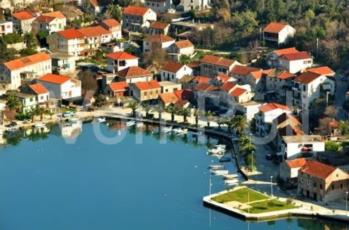
Rogotin is located halfway between Split and Dubrovnik, on an island surrounded by the Black River on the north side and its tributary on the southwest, which connects it with the Adriatic Sea with its western symbol, Lake Vlaška. According to legend, Rogotin began to settle in 1716, when the Venetians left Citluk (Gabela) to the Turks, and the population withdrew to the army under Venetian rule. For a long time, Rogotin was an isolated settlement, which could be approached by waterways - the Black River and the Neretva. At first, the people of Rogotin were engaged in agriculture, and in addition to agriculture, the source of livelihood was fishing and coot hunting. Once a small and isolated village, Rogotin is now fully open and integrated into modern life, which economically connects it with the nearby Ploče, and culturally with the whole of Dalmatia and Croatia, without losing any of its tradition that makes it one of the most characteristic and recognizable Neretva places. Source: www.rogotin.hr
Prigradica
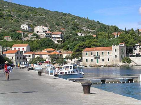
Prigradica used to be a port through which Blato exported their wine and oil, and today is a tourist resort which has retained the atmosphere of the small port.
In the bay there are numerous houses for rent with private apartments, restaurants, supermarket, soccer fields, basketball, water polo and beach volleyball. There are also bicycle and hiking trails, and summer movie nights are held there.
Prigradica is connected to Korcula, Hvar and Split with a catamaran line, and from Blato it is 4 km away.
Source : TZ Blato
Vela Luka
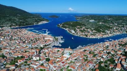
Vela Luka is a small town situated on the western side of the island of Korčula in a deep wide bay. The bay of Vela Luka abounds in numerous coves covered with vineyards,olive groves, fig trees and pine trees.
With the population of 4500, Vela Luka is the biggest place on the island.
It's a safe anchorage and nautical harbor.
Vela Luka is an attractive destination due to its mild climate and natural beauties such as sweeping views, clear sea and beautiful beaches. Moreover, it is rich with cultural heritage, various sport and entertainment events, and most importantly with kind and hospitable hosts
Brna
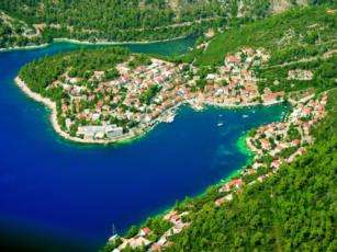
Brna is situated at the southern part of Korčula island in a beautiful bay surrounded by greenery and the Sun. At the western side is Mali Zaglav peninsula, which separates Brna from Istruga bay, whilst on the southeast side there are several pebble bays surrounded by pine forest and the blueness of the sea. The climate in Brna as well as on the whole island is Mediterranean with long and warm summers and short and mild winters. In summers the west wind or ‘Mistral’ is ideal for all those who love wind surfing. The Brna bay is deep and sheltered and is therefore a safe port for ships and yachts. It is a favourite among the sailors. The close by bay of Istruga is 500 m long and 150 m wide. Half of the bay is covered by six meter beds of healthy liman mud, which belongs to underwater peloid whose development process lasts at least thousand years. The entire area is surrounded by pine forest and Mediterranean herbs so the walks in this area offer are a real pleasure. Cristal clear see, beaches and hidden bays, naturism islets, beautiful sunsets, aromatic herbs, clean nature and air.........all this is Brna, a place where you can find accommodation in a hotel or in a beautiful privately owned house. Brna offers a unique combination of beautiful nature and fun. The hosts will offer you gastronomic specialities and local wine. Soon you will make friends and will want to return again...
Viganj
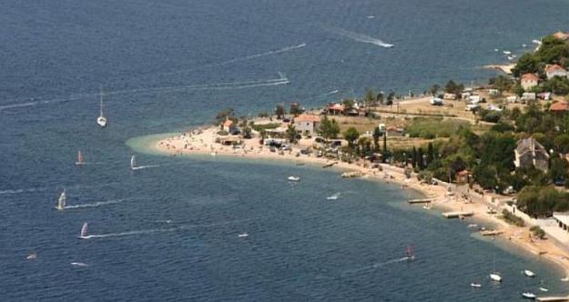
-